
-
 7571 Hits
-
 84.27% Score
-
 18 Votes
|
|
Mountain/Rock |
|---|---|
|
|
46.60223°N / 12.70794°E |
|
|
Hiking, Scrambling |
|
|
Summer, Fall |
|
|
8035 ft / 2449 m |
|
|
Overview
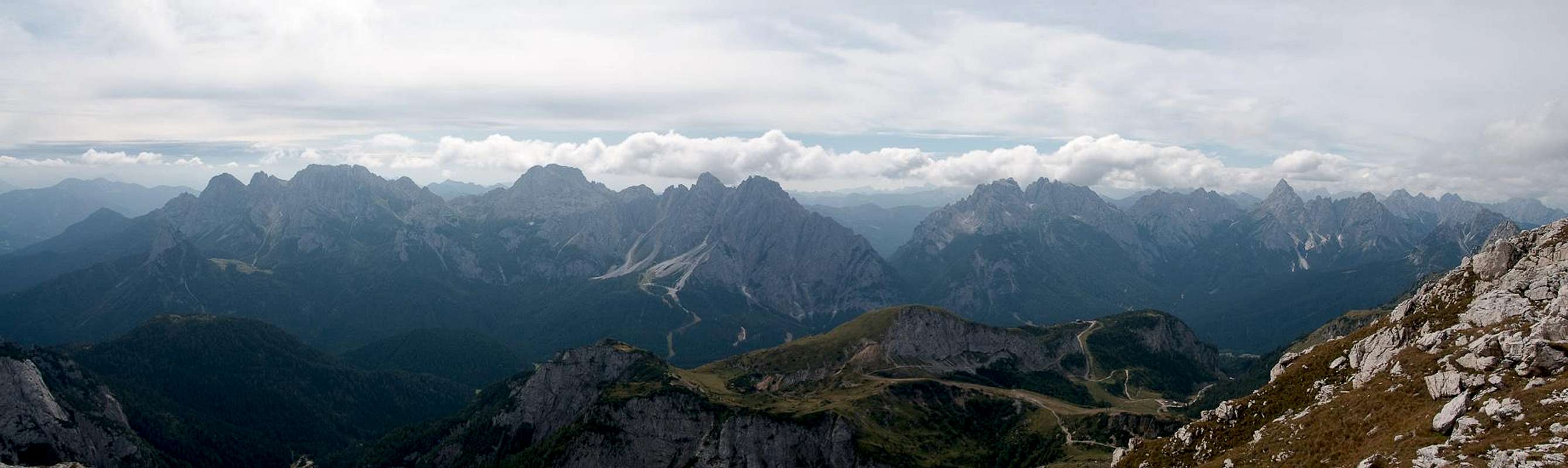
 En Route to Monte Lastroni En Route to Monte Lastroni |
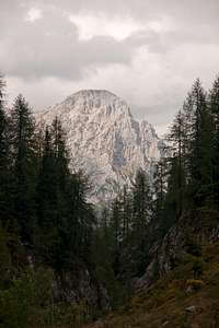
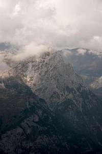
When preparing for my September 2009 vacation to Sexten / Sesto I asked ganesh70 for recommendations in the greater area of Sappada on the Piave River. Among others he recommended Monte Lastroni as one of the best lookout-peaks in the area. And he was right! Even though during our climb weather was far from perfect the mountain's location between the Carnic Alps Main Ridge and the Southern Carnic Alps with their impressive limestone and marble mountains ensured wonderful views.
 |  |  |
Monte Lastroni stands at the eastern end of the Monte Rinaldo Group, which is considered to be part of the Carnic Alps Main Ridge though it is located a bit to the south and stands separately. After Monte Rinaldo it is the second highest summit of the group. Both mountains are connected by a long ridge of questionable rock quality. The mountains of the group are made up from brittle limestone, which creates massive scree fields at the bases of the group. Especially the north faces appear to be rapidly decomposing, a quick glimpse will tell you to stay away.
 |  |  |  |
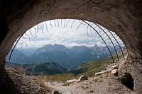
Monte Lastroni is the easiest of the mountains of the group since it can be reached by solid hiking trails which date back to the days of WW I. During the war, the whole crest of the Monte Rinaldo Group served as entrenchment for Italian Alpini. They could command the valleys and plains to the north of the group, which separate it from the main ridge. The latter, in this part, consists of grass covered low summits, which could not be secured easily. Today, along the route to Monte Lastroni, you still find multiple positions dating back to the Great War, some of which amount to caves with window-like lookouts into the north face of the mountain.
 |  |  |  |
The easiest access route to Monte Lastroni follows Val della Miniera towards the Laghi d'Olbe, three lakes, which lie in the bend that Cresta Righile forms right between Monte Rinaldo and Monte Lastroni. It's a very popular spot, which in summer can be reached from the Sappada chair lifts by a hike of little more than half an hour. A second route traverses the scree fields in the north of the mountain, aiming for Passo del Mulo on Cresta Righile. The quality of that route, however is very low.
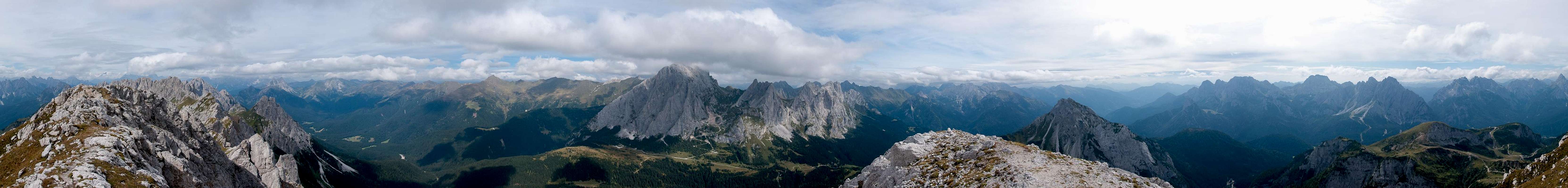
360° Summit Panorama
  |
Getting There
 |
The trailheads for Monte Lastroni are located in Val di Sesis, the valley, which leads from Cimasappada to the sources of the Piave River. The eastern trailhead is at Baita del Rotodendro, the northern one at the Rifugio Sorgente del Piave.
From Veneto
- Take motorway A27 from Venezia (Venice) to Ponte nelle Alpi
- Take SS51 (Alemagna) to Pieve di Cadore
- Take SS51bis to Lozzo di Cadore
- Take SS52 to Santo Stefano di Cadore
- Take SR355 to Cimasappada
From Südtirol / Alto Adige
- Take Brenner motorway A22 to Bressanone (Brixen)
- Take SS49 through Val Pusteria (Pustertal) until you reach Innichen (San Candido)
- Take SS52 (Carnica) to Santo Stefano di Cadore
- Take SR355 to Cimasappada
From Austria (Lienz)
- Take B100 from Lienz to the Austrian / Italian border
- Take SS49 to Innichen (San Candido)
- Take SS52 (Carnica) to Santo Stefano di Cadore
- Take SR355 to Cimasappada
Red Tape
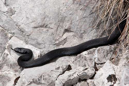 Black Vipera berus - European Viper
No red tape in this area
Accommodation
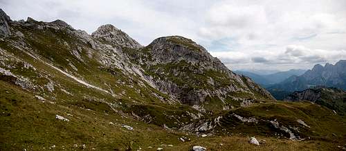 Monte Lastroni
Weather Conditions
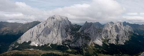 Monte Peralba, Monte Chadinis, Monte Avanza and Monte Navastolt
Maps & Books
Maps
- Tabacco Map 001
SAPPADA-S.STEFANO-FORNI AVOLTRI
1:25000
ISBN: 978-8883150012
Maps Online
Books
- Friulanische Dolomiten & Karnische Alpen
Ingrid Pilz
Carinthia Verlag
ISBN: 978-3853785959